
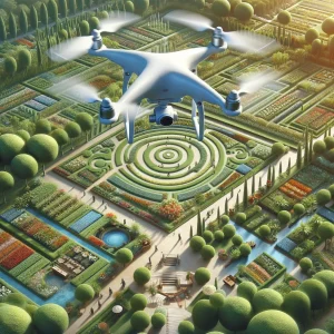
In the ever-evolving world of landscaping, keeping track of project progress is crucial. Traditional methods of monitoring and documenting progress can be time-consuming and sometimes inaccurate. Enter drone photogrammetry—a cutting-edge technology that provides high-resolution aerial photos, offering a bird’ s-eye bird’s-eye view of your project. This innovative approach is revolutionizing the way landscapers and gardeners track their work.
What is Drone Photogrammetry?
Drone photogrammetry involves drones with high-resolution cameras to take detailed aerial photographs of a landscape. These images are then processed to create accurate, three-dimensional maps and models of the area. This technology allows for precise measurement and analysis, making it easier to track changes and progress over time.
Benefits of Drone Photogrammetry for Landscapers
- High-Resolution Imagery: Drones can capture incredibly detailed images, providing a clear and comprehensive view of the entire project site. This level of detail is invaluable for planning, monitoring, and documenting landscaping projects.
- Time Efficiency: Traditional surveying methods can be time-consuming and labour-intensive. Drones can cover large areas quickly, providing data in a fraction of the time.
- Improved Accuracy: Drone photogrammetry’s precision reduces the likelihood of errors in measurements and documentation. This ensures that every aspect of the project is accurately recorded and monitored.
- Cost-Effective: While the initial investment in drone technology may seem high, the time saved and the accuracy gained can lead to significant cost savings in the long run.
Real-World Applications
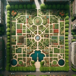
Example 1: Garden Design and Layout
A landscaping company in California used drone photogrammetry to design a large public garden. They could create a detailed 3D model of the area by capturing aerial images. This model helped them plan the layout, including pathways, flower beds, and water features, ensuring everything fit ideally within the space. The high-resolution images allowed for precise measurements, reducing the need for costly adjustments later.
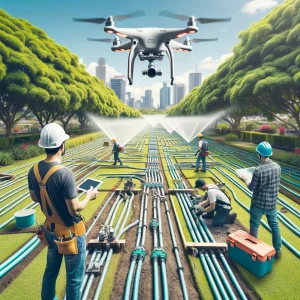
Example 2: Monitoring Irrigation Systems
In Texas, a gardening service used drones to monitor the installation of an extensive irrigation system in a newly developed park. The aerial photos provided a clear view of the entire site, allowing the team to ensure that all irrigation lines were correctly placed and functioning properly. This improved the installation process’s efficiency and helped quickly identify and address any issues.
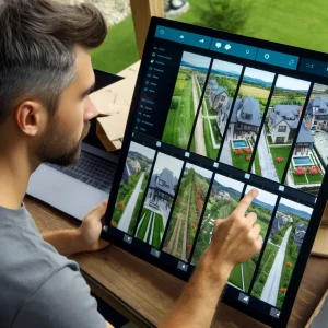
Example 3: Documenting Project Progress
A landscaper in Florida employed drone photogrammetry to document the progress of a large residential landscaping project. They created a visual timeline of the project’s development by taking aerial photos. This helped communicate progress to the clients and provided a valuable reference for future projects.
How to Get Started
- Choosing the Right Drone: Choose a drone with high-resolution cameras that is suitable for the size and complexity of your projects. Some popular models include the DJI Phantom 4 RTK and the Parrot Anafi USA.
- Learning the Basics: Familiarize yourself with the basics of drone operation and photogrammetry software. Many online courses and tutorials can help you get started.
- Obtaining Necessary Permits: Ensure you have the required permits to operate a drone in your area. Regulations vary, so check with local authorities.
- Investing in Software: Invest in reliable photogrammetry software like Pix4D, DroneDeploy, or Agisoft Metashape. These tools will help you process the aerial images and create accurate 3D models.
Drone photogrammetry is transforming the way landscapers and gardeners approach their projects. By providing high-resolution aerial photos and accurate data, this technology enables more efficient planning, monitoring, and documentation. Whether you’re designing a new garden, installing an irrigation system, or simply tracking the progress of a project, drone photogrammetry offers a powerful tool to enhance your work and deliver better results.